
Highbank Lake
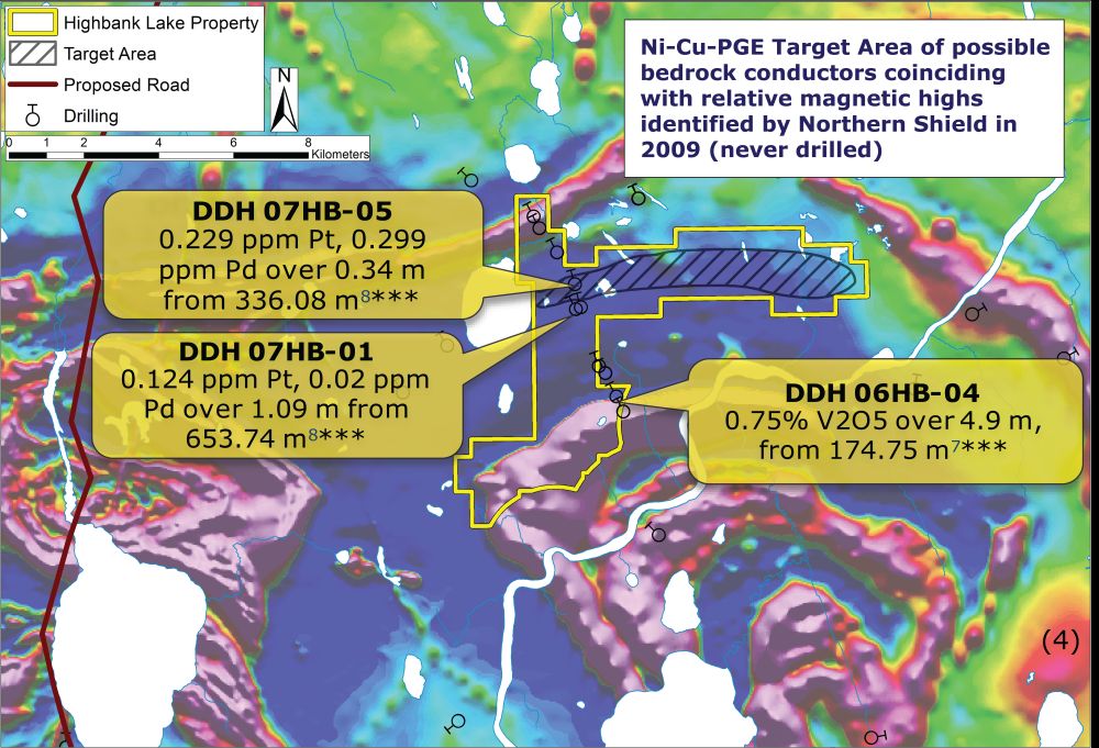
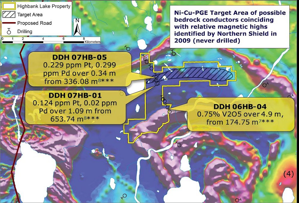
EMX’s Highbank Lake covers portion of the Fish Trap Intrusive Complex (FLIC) in the Porcupine Mining District. The FLIC is composed generally of folded, layered sequences of gabbro, anorthosite and pyroxenite which can be traced for up to 26km using regional geophysics(1). Historic drilling has confirmed the intrusive complex is mineralized at multiple depths. A number of features indicate regional folding, which could result in repeated mineralized beds occurring on EMX’s land position.
Mineralization is interpreted as part of a to 22km curvilinear, magnetite-rich, PGE-bearing reef which skirts the Highbank project(2). Significant Pt-Pd anomalies have been identified in soils nearby(2) and nearby drilling (00’s) intersected sulfide mineralization at multiple intervals although no assay results are reported(3).
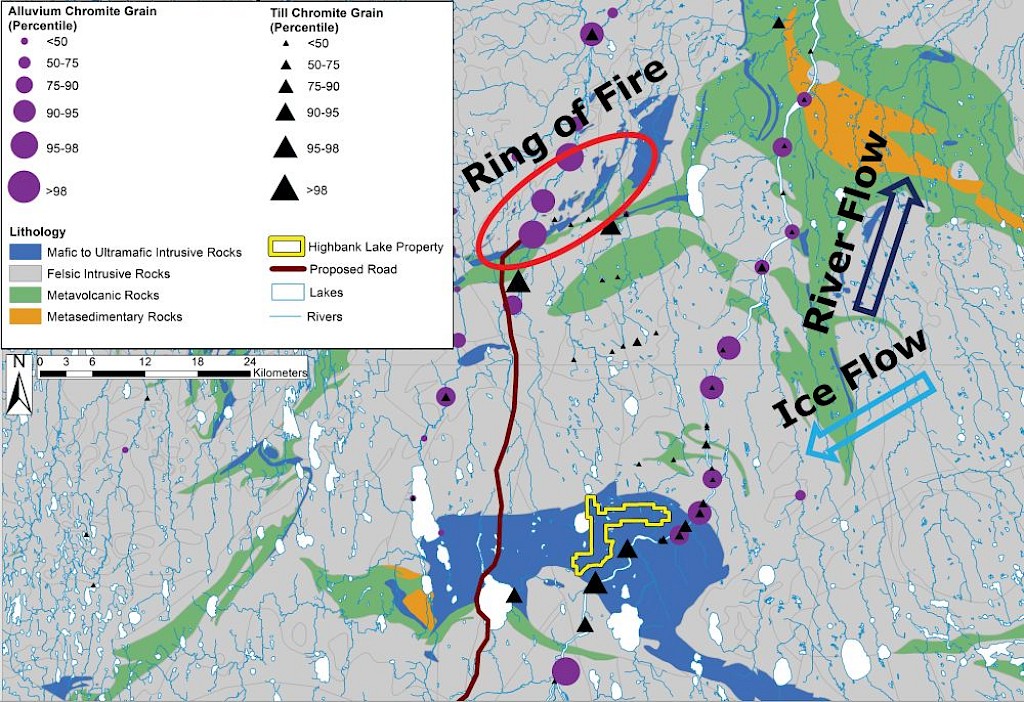
The property is located 30km south of Wyloo Metals’ Ring of Fire project which hosts deposits of chromite, nickel-copper-platinum-palladium Drilling was completed in the early 2000’s and requires follow-up investigation from the EMX team.
Results from gov’t till and alluvium sampling in 2016 shows increased chromite grain counts, both down ice and down stream of the FLIC – a similar signature of the Ring of Fire area. EMX plans to conduct peat geochemistry and SGH sampling over the interpreted target area, as outlined in MRD 399(6).
Maps
 Click to Enlarge
 Click to Enlarge
The nearby deposits provide geologic context for EMX’s Project, but this is not necessarily indicative that the Project hosts similar tonnages or grades of mineralization
(1) http://www.geologyontario.mndm.gov.on.ca/mndmfiles/afri/data/imaging/20000000665/20001519.pdf
(2) http://www.geologyontario.mndm.gov.on.ca/mndmfiles/mdi/data/records/MDI000000001740.html
(3) http://www.geologyontario.mndm.gov.on.ca/mndmfiles/afri/data/imaging/20000000665/20001519.pdf
(4) Ontario Geological Survey 2017. Report on magnetic supergrids, 14p. [PDF document]; report in Ontario airborne geophysical surveys, magnetic data, grid data (ASCII and Geosoft® formats), magnetic supergrids; Ontario Geological Survey, Geophysical Data Set 1037—Revised.
(5) Gao, C., Crabtree, D.C., Dyer, R.D. and Clarke, S.A. 2021. Indicator mineral and geochemistry data for the till and alluvium sampling survey in the McFaulds Lake (“Ring of Fire”) area, northern Ontario; Ontario Geological Survey, Miscellaneous Release—Data 322 – Revised.
(6)Handley, L.A. and Dyer, R.D. 2022.Geochemistry and soil gas hydrocarbon data from a peat sampling transect over the Eagle’s Nest nickel-copper and Blackbird chromium deposits, McFaulds Lake (“Ring of Fire”) area, northern Ontario; Ontario Geological Survey, Miscellaneous Release—Data 399.
(7)http://www.geologyontario.mndm.gov.on.ca/mndmfiles/MDI/data/records/MDI000000000691.html
(8)http://www.geologyontario.mndm.gov.on.ca/mndmfiles/afri/data/imaging/20000004234/20006320.pdf
Photos
©2024 EMX Royalty Corp. All rights reserved. | Website by Adnet | Privacy Policy | Web Accessibility Policy