
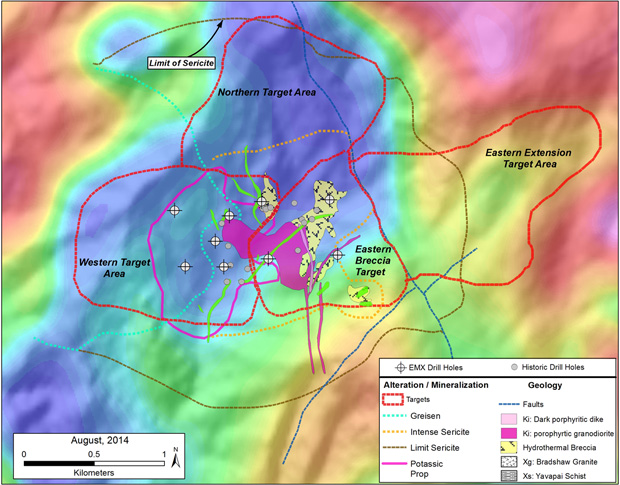
Copper Basin, Arizona
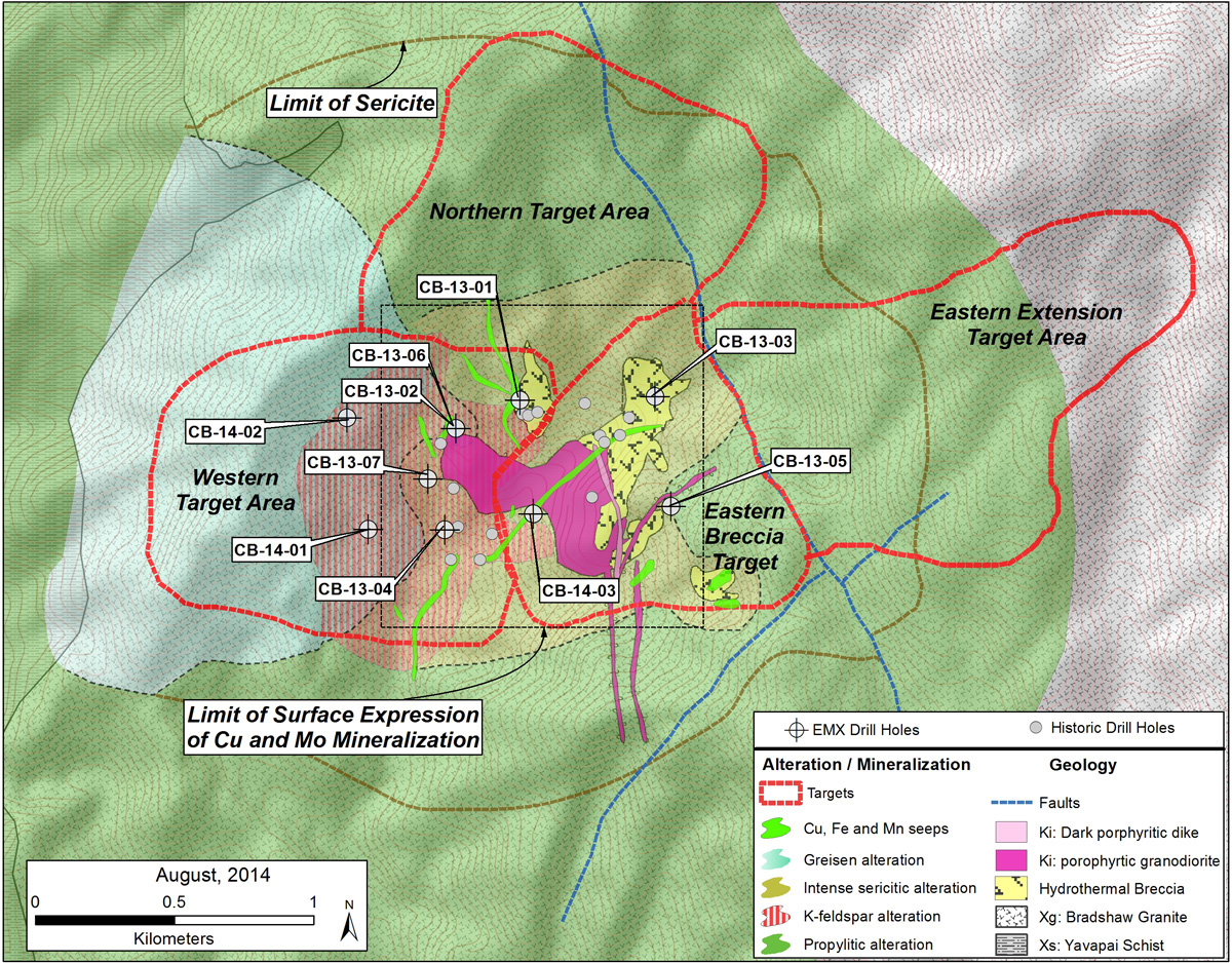
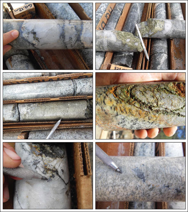
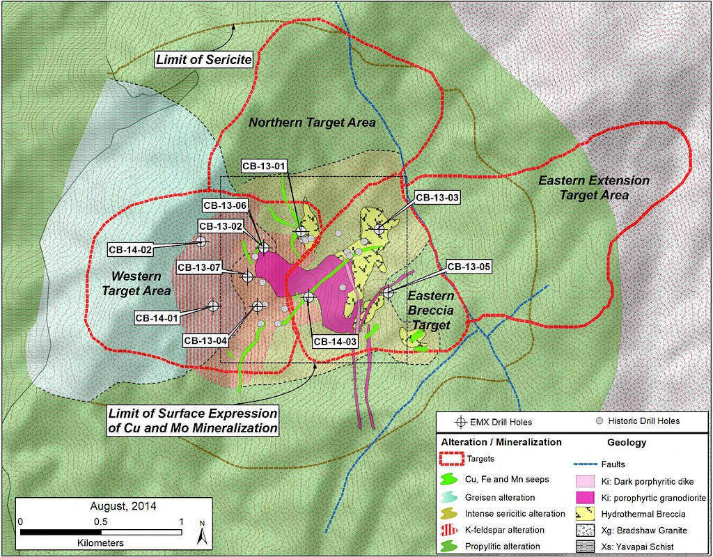
Copper Basin is a porphyry copper-molybdenum project in central Arizona, about 80 kilometers northwest of Phoenix and is available for partnership. The porphyry system has nearly a kilometer of vertical extent within a 1.5 square kilometer area of exposed alteration, mineralization, and related geophysical anomalies. The geology consists of Proterozoic granites cut by younger Laramide-age quartz diorite stocks and dikes. These rocks are cut by zones of quartz-pyrite-chalcopyrite-molybdenite veins, stockworks, and mineralized breccias. In addition, numerous surface shows of mineralization are exposed along Copper Creek and its tributaries as copper seeps, ferricretes, and manganocretes. Many of these occurrences lie outside of the EMX drill tested area. Copper Basin is available for partnership.
Historic work during the 1960-1970s focused on the core of the exposed system that was interpreted as an upright porphyry target. EMX’s structural geologic interpretations suggest that the Copper Basin porphyry system is tilted >65°, topping to the east.
EMX completed a partner-funded, seven hole diamond drill campaign totaling 2,776m in 2013. The drill results indicated the mineralized system starts at the surface, and six of the seven drill holes bottomed in copper-molybdenum mineralization. Hole CB-13-01 was altered and mineralized over its entire 919.7 meter length, and averaged 0.34% copper equivalent (0.18% Cu and 0.029% Mo)1. A partner-funded drill program in 2014 consisted of three core holes totaling 1,140 meters that partially tested the western and central target areas. This drilling intersected anomalous (~0.04-0.20% Cu) to low grade (~0.2-0.4% Cu) mineralization, and yielded geologic results consistent with BCE’s model of a tilted porphyry system. This recent drilling, combined with results from the 2013, and 2019 program, indicate the potential for higher-grade zones north and east of the areas drill tested to date.
See Company new release dated June 27, 2013 for more information on the drilling program.
1 Copper equivalent calculated with a 5.5 Mo:Cu ratio and assumes that metallurgical recoveries and net smelter returns are 100%. Reported intercepts are interpreted as true widths in porphyry style mineralization.
Maps
 Click to Enlarge
 Click to Enlarge
Photos
 Click to Enlarge
©2024 EMX Royalty Corp. All rights reserved. | Website by Adnet | Privacy Policy | Web Accessibility Policy