
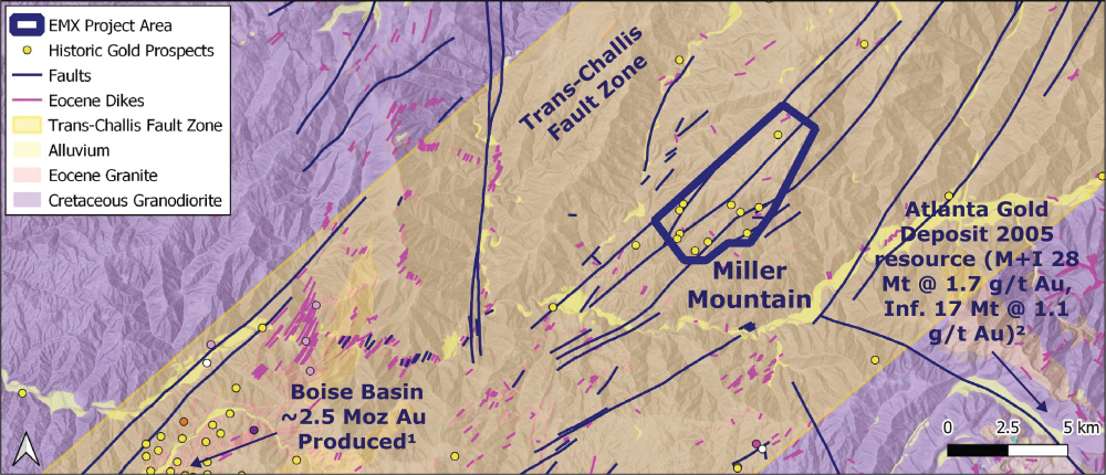
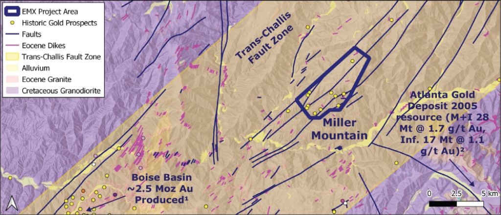
Miller Mountain, Idaho
The Miller Mountain project is located 75 km northeast of Boise, ID, and is a district-scale project (7.5 km strike length) within the regionally mineralized Trans-Challis Fault Zone (>3 Moz historic projection)1. The project has an analogous mineralization style to the Atlanta district*, ID 50 km to SW, (2005 historic resource: M+I 28 Mt @ 1.7 g/t Au, Inf. 17 Mt @ 1.1 g/t Au)2. There are two non-NI 43-101 historic resources on property at Miller Mine3 and Specimen Mine4 that are open for expansion.
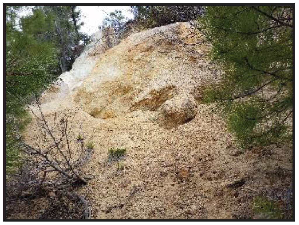
The project is in a Cretaceous granodiorite intruded by Eocene intermediate to felsic porphyry dikes. Structurally, the Trans-Challis Fault Zone in a right-lateral to normal, E-W striking zone with en echelon vein systems and shear zones. Alteration consists of quartz-pyrite-electrum veins with proximal sericite and localized distal chlorite alteration of the host granodiorite.
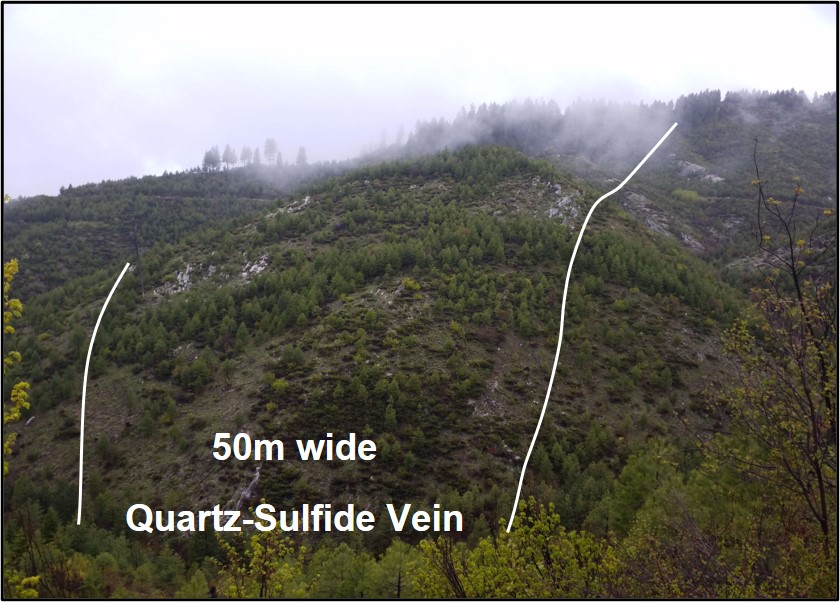
There are two target types in the Miller Mountain project. First, bulk tonnage (surface mineable gold) has disseminated mineralization in outcrops at the Specimen mine containing multiple > 5 g/t Au samples (n=4 avg. 5.5 g/t Au)2 and a historic resource is open for updated definition and expansion. There is also a major residual placer gold zone in the north with minimal outcrop and quartz vein float. Second, high-grade (underground quartz vein-hosted hold) at the Miller mine has a historic resource in a 1.8 m wide (average) quartz-pyrite-electrum vein with a potential for resource expansion along strike and at depth. Dozens of additional quartz-sulfide veins (up to 50 m wide) are also observed throughout the property with no history of exploration.
The Miller Mountain project is a great opportunity to advance a district-scale property within an established multi-million ounce1 regionally mineralized structure. High-grade rock chip samples (>5 g/t) were collected throughout the property by EMX and the U.S. Bureau of Mines2. There are widespread lode and placer gold occurrences on the project needing further exploration, minimal outcrop, and opportunity for shallowly concealed veins and disseminated zones. Miller Mountain has drill-ready targets near historic resources. With systematic mapping, stream and soil geochemistry (strong Au-Ag-As geochemical association), and geophysics, additional targets can be generated.
1 Trans-Challis Production, USGS: Koschmann and Bergendahl, 1968. Principal Gold-Producing Districts of the United States. Professional Paper 610.
2 Atlanta Gold 43-101 Technical Report and Updated Resource Estimate on the Atlanta Gold Property, June 30, 2011. Prepared by: P&E Mining Consultants, June 30, 2011
*The nearby mines provide geologic context for EMX’s Project, but this is not necessarily indicative that the Project hosts similar tonnages or grades of mineralization.
EMX has not done sufficient work to classify the NI 43-101 historic resource estimates as a current resource estimate, but believes the estimate is relevant and reliable.
Maps
 Click to Enlarge
Photos
 Click to Enlarge
 Click to Enlarge
 Click to Enlarge
3 U.S Bureau of Mines, 1993. Mineral Resources of the Red Mountain Roadless Area, Boise Custer, and Valley Counties, Idaho.
4 Northern Miner, 1989. WestGold Ready to Probe USAC’s Idaho Gold Project.
©2024 EMX Royalty Corp. All rights reserved. | Website by Adnet | Privacy Policy | Web Accessibility Policy