
Beaver Peak, Nevada
Beaver Peak Gold is located 40 km NW of Carlin, Nevada with lodging and support services. It can be accessed by paved and gravel roads from Carlin. The gravel and dirt roads are maintained throughout the property. The property is 342 unpatented lode mining claims staked by EMX in the fall of 2019. Beaver Peak is on BLM land, and EMX owns 100% of the project with no underlying royalties.
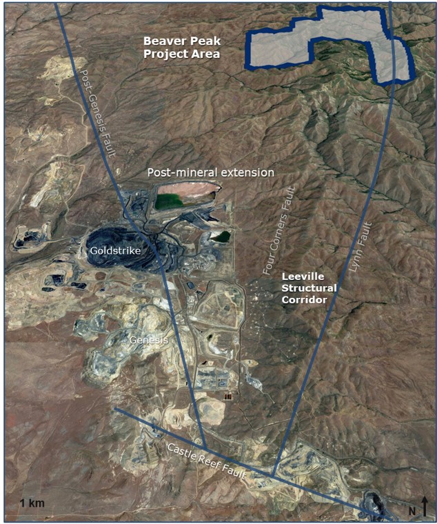
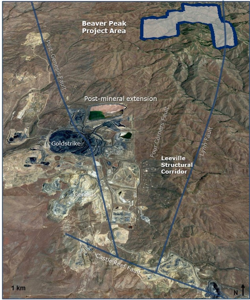
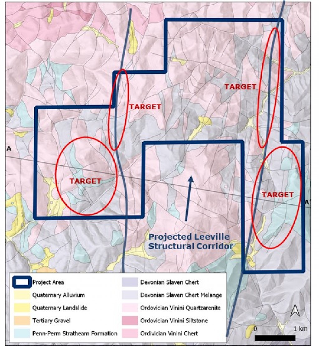
Beaver Peak is a large land position along an underexplored portion of Nevada’s Carlin Trend. The property is 10 km NNE of two of the largest mines on the Carlin Trend; Nevada Gold Mines’ Goldstrike Complex and Leevile Complex. It is also along projection of the regionally important Leeville structural corridor.
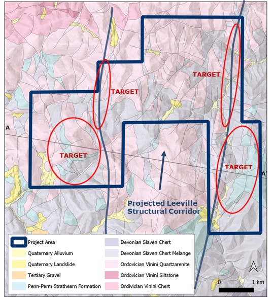
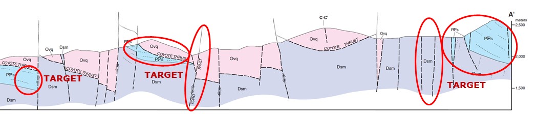
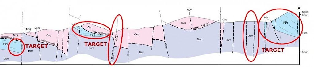
The project area is dominated by mapped Ordovician-Devonian siliciclastic units within the Upper Plate of the Coyote thrust fault, time-equivalent to the Roberts Mountains thrust fault – a regional control on mineralization in the Carlin Trend (Teal and Jackson, 2002). Pennsylvanian-Permian overlap sequence limestone, dolomite, pebble conglomerate occurs throughout property (analogous to Antler sequence, dominant host to gold mineralization in the Battle Mountain district). Discrete N-S, NE, and NW fault networks identified – N-S structures correlate with projected Leeville structural corridor.
Targets are shallow oxide gold hosted within calcareous units of the Pennsylvanian-Permian Strathearn Formation (e.g., Battle Mountain district) beneath the Coyote thrust fault. Other targets are deeper sulfide mineralization in Lower Plate Devonian-Silurian units along altered and/or mineralized structural feeders at surface.
The nearby mines provide geologic context for EMX’s Project, but this is not necessarily indicative that the Project hosts similar tonnages or grades of mineralization.
Maps
 Click to Enlarge
 Click to Enlarge
 Click to Enlarge
Geologic map and cross section from: Theodore, T. G., Moring, B. C., Harris, A. G., Armstrong, A. K., & Finney, S. C. (2003).
Geologic map of the Beaver Peak quadrangle. Elko and Eureka Counties, Nevada: Nevada Bureau of Mines and Geology Map, 143
Photos
©2024 EMX Royalty Corp. All rights reserved. | Website by Adnet | Privacy Policy | Web Accessibility Policy